Abuja, Nigeria’s political capital located in the middle of the of the country, is a product of the deficiencies of Lagos, the former capital on the country’s Atlantic coast.
As Nigeria entered the oil boom in the early 1970s and became awash with cash that funded a surging middle class that displayed its new-found wealth with the acquisition of automobiles, Lagos found itself paralyzed by congestion. The city originally designated Nigeria’s capital by British colonialists suddenly found itself suffocating and unable to move, paralyzed by the sheer numbers that thronged to what amounted to the tap from which the oil money flowed.
By 1974-75, Lagos bore tales of legendary traffic jams of the sort that rooted cars to one spot for a whole day. Often drivers were forced to abandon their cars on the road and went home only to return in the wee hours to retrieve their vehicle

By 1976 the situation compelled the Murtala Mohammed administration that was in power at the time to set up the Akinola Aguda commission to seek a solution to the problem. That commission came up with the recommendation to move the political capital elsewhere in the country. The ideal, the body reasoned, was to move the capital to somewhere neutral, not dominated by one ethnic group as Lagos was by the Yoruba. And the geographical centre of the country was therefore chosen.
Actual implementation was long in coming. Though the building of the new capital had begun by the 1980s, it progressed slowly, sometimes raising the question whether successive governments were genuinely committed to the relocation.
All this changed after the then military ruler General Ibrahim Babangida survived a bloody military coup in April 1990, during which his Lagos residence was bombarded by junior officers as he made a narrow escape. This exposed the defensive inadequacies of the presidential residence. Babangida responded by injecting a new urgency into the planned move to Abuja.
The building of a heavily fortified presidential residence commenced soon after at the foot of the Aso Rock monolith in Abuja. On completion, Babangida moved to Abuja in 1992 and ordered all federal institutions to follow suit immediately.
Since then the city has grown astronomically, becoming another fountain from which Nigeria’s petrodollars flowed, causing people to flock not only to the city but also to its surrounding satellite communities.
Today Abuja city is estimated to have at least two million people with another three million living in satellite areas such as Gwagwalada, Suleja, Zuba, Deidei, Mararaba, Nyanya and Karu.
One of the consequences of the hasty move ordered by Babangida was that the çity lacked adequate housing at the time, creating a housing-price inflation that made most of the working people that moved to the city unable to afford it’s expensive housing. Most people made do with houses in the surrounding towns and villages, with only the rich able to find housing inside the city.
Thus was created an apartheid city to which the working class commuted from hovels in the satellite areas in the morning to their work places, leaving again at the end of the day.
Early history
The earliest inhabitants of the area where Abuja is located are the Gwari or Gbagyi people. Believed to have had connections with the Nupe and the Jukun, many of them moved into the area of Abuja during the Nok culture era, as ancient figures and figurines found in the area show.
Another wave of significant movement into the Abuja area was under pressure from the 19th century jihad waged by Usman Sam Fodio, the Fulani cleric that founded the Sokoto Caliphate. This period saw the southward movement of the Hausa ethnic group into the region, with the introduction of Islam, followed by Christianity in the 20th century.
From the earliest times the Gwari established a tradition of settling on the various mountains, hills and other high points in the area as a military strategy that enabled them to spot invaders in good time to counter them. For this reason they accorded spiritual significance to the various hills and monoliths in the area, such as the Zuma rock, the Aso rock and others. With the onset of the modern era the Gwari began to move from the higher lands into the plains.
The Gwari were mostly farmers, fishers, hunters and excellent makers of pottery.
They have one of the most resilient traditional cultures. One of the most famous manifestations is the practice of sparing the head of heavy loads that are instead carried on the shoulder. This based on the belief that the head is sacred as the seat of wisdom and thought, which shouldn’t be burdened to ensure its optimum performance.
The most renowned Gwari potter of contemporary times was Ladi Kwali, a woman who lived in the 1950s and combined traditional and more modern techniques in her work. One of the most enduring gifts of Gwari pottery is the Giri pot. Usually with a slim neck with a handle on either side joining it’s brim with the bulge, it is today in high demand as home decor by themselves, flower vases or for the storage of grains.
Weather and topography
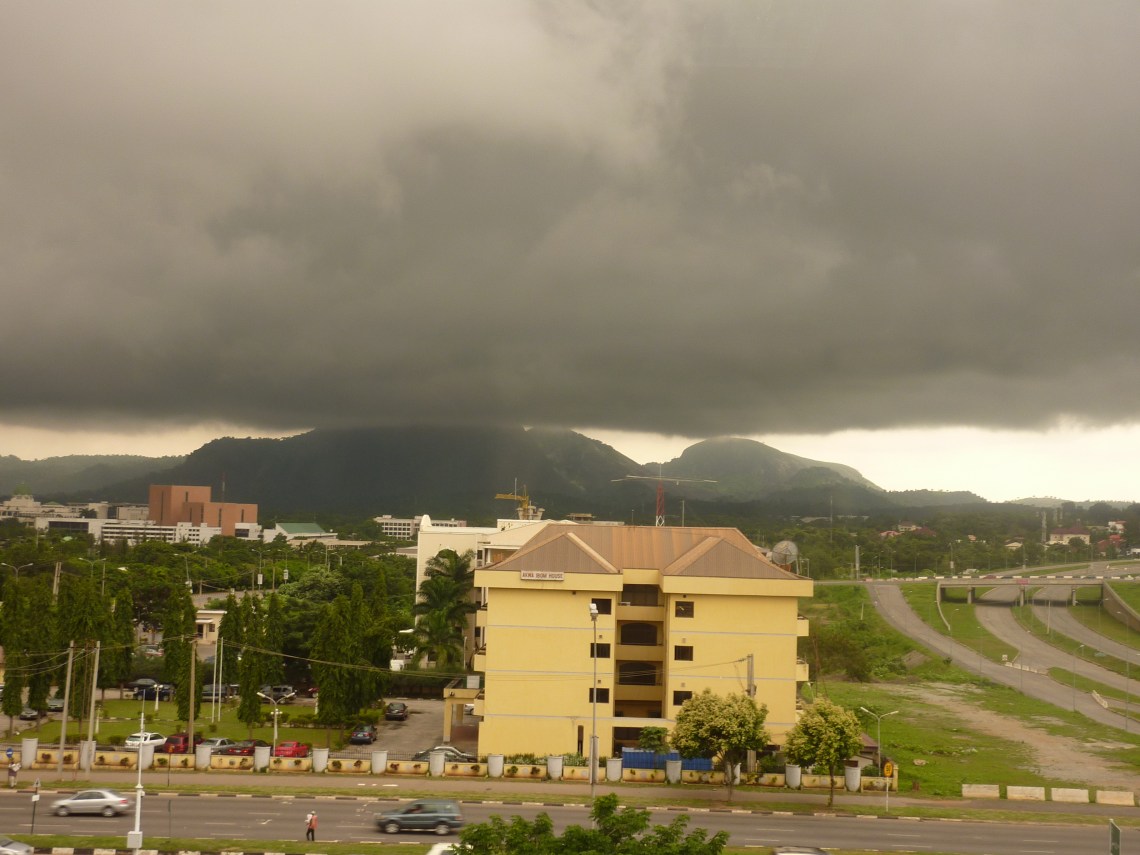
Abuja, like most of Nigeria, features two distinct weather patterns, the dry season and the wet season. The dry weather from November to March features intermittent waves of cold, dry north-southerly wind from the Sahara Desert, that leaves a shroud of dust particles hanging over the city. This season features extremes of temperatures, sometimes as cold as 12 degrees Celsius at night and in the mornings, then going as high as 38 degrees Celsius in the afternoons.
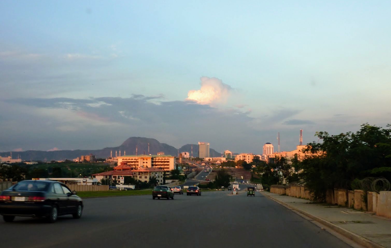
The rainy season gets underway in April, and by the time it takes full hold between July and September, temperatures range between 18 and 27 degrees Celsius. The dry season dust haze clears with the rains, making the hillocks, monoliths and the escarpment surrounding the city very visible.
Abuja’s vegetation falls within the woodland savannah classification, combining grassy plains dotted by trees with occasional rain forest tickets in the southeast of the city that features a scraggy, jagged landscape of valleys and hills.

A Modern Abuja Emerges
Abuja’s construction is based on a master plan drawn up a group known as International Planning Associates. It was made up of three U.S. firms, the Planning Research Corporation, Wallace, McHarg, Roberts and Todd, and Archisystems. This accounts for the similarity of the city’s layout with that of many U.S. cities. The detailed design of Abuja’s city centre was the work of a Japanese architect, Kenzo Tange and members of his team.
Abuja was planned to unfold in phases, with the first one covering the Central Business District or Central Area, the the earliest residential areas such as Garki, Wuse, Maitama and Asokoro. The second phase added new districts such Gudu, Durumi,Utako, Wuye, Kado, Kaura, Mabuchi and Katampe among others. Gwarimpa, Galadimawa, Dakwo, Lokogoma, Idu and about 6 other zones were meant to come under the third phase.

Additional suburbs were then created to outlie these core city areas. These include Nyanya, Gwagwalada, Jukwoyi and Karu. Other settlement clusters surrounding the city created were Lugbe, Pyakassa, Kuchigworo, Mpape, Deidei, Gwagwa, Chika and Karimu.
As of 2016, Abuja’s population was estimated to be about 6 million, half of which lived in the main city and suburbs, with the other half living in the satellite areas. United Nations’ estimates show that its population more than doubled from 2000 to 2010, when it grew faster than ant city in the world, before slowing to an annual growth rate of about 35 percent.
Initial development of Abuja’s infrastructure focused on building it’s road network. An airport was built with temporary facilities that are now being upgraded to accommodate growing demand. A standard gauge rail line has been built to link Abuja with the northern city of Kaduna, with plans afoot to link the city and its suburbs and the outlying districts.

Hospitality and Culture
Abuja is reputed to have perhaps the country’s highest number of hotels per capita. These include top of the range hotels such as the Transcorp Hilton and the Sheraton, as well as a large selection of mid-range hotels and a large assortment of others.
The city is also unique with its open-air restaurants or marquees, better known in Abuja as gardens. Most of them usually come alive at night and are renowned for their grills, a wide range of local fares and music provided by either deejays or live bands.
A frequent criticism of Abuja is that the city lacks a soul and has an artificial mien, not having grown organically like most of the country’s other cities. However, the city’s soul is to be found in it’s natural surroundings, from the escarpment around the city, marked by the monoliths of Ado Rock and Zuma Rock on either end; in the many rocky hillocks and the many streams and brooks that criss-cross the city, making it a natural beauty.
